Landslides
| Slope failures are becoming more widespread, and have over the years caused more human, socio-economic, and environmental losses than any other geologic hazard in Sierra Leone. Landslides, mudslide, and rockfall (hereafter landslides) is a general term covering a wide variety of mass movements and processes involving down slope transport of soil and rock material in mass under the influence of gravitational forces. Although this is a part of the Earth's denudation process and thus considered as a natural phenomenon, slopes which stood safe for centuries are now frequented by landslides and hence socio-economic losses due to its impact are growing. |
 |
This is mainly due to the expansion of human activities into more vulnerable hill slopes under the pressure of rising population and associated demands for land and infrastructure facilities.
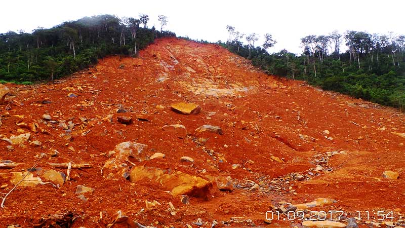
The Sierra Leone’s relief is characterized by hilly and mountainous regions in the Western Area Peninsula and towards the Northeast of the country, with an average altitude between 500 and 750 metres. The recent landslide event that hit the Western Area is considered the most devastating disaster event after the Ebola Virus Disease (EVD). The landslide (mudslide) was triggered by heavy rainfall overnight on the 14 August 2017 in the Matome, Regent community, where a slope in the Sugar Loaf Mountain overlooking a densely populated community failed, burring dozens of houses within its immediate vicinity and damaging or destroying many more along the path of the mudflow into the Atlantic Ocean (see Table 4-2).
From DesInventar data, around 250 people were affected by landslides between 2009 and 2016, among them 57 died and 50 others were injured and about 20 houses were damaged or destroyed. The details of the events that are available from DesInventar are presented in Table 4-1.
From the entire available inventory of landslide disaster events in Sierra Leone, the most impacted region is the Western Area with more than eighty percent of the total deaths records (89%), followed by the Northern Province with eleven percent of the total cases. Western Area Urban and Western Area Rural experienced more deaths than others, with Bombali, and Port Loko being the only other Districts to have experienced landslide disaster events recent time . See Table 4-1 for more details.
During the last decades, it is noted that the most vulnerable category of Sierra Leone is composed of households who are located in sloppy areas of the Western Area and the Northern part of the provinces. These people stay often in houses of areas classified as “high risk zones”. Most of the area and are characterized by a very fragile settlement and modest income .
Freetown Peninsula, which is most affected by landslide disasters is composed predominantly of gabbroic rock. It forms steep high hills with a relatively flat coastal plain consisting of thick laterite soil overlying weathered hard-pan laterite and gabbro rock. Due to high rainfalls (especially between July and September), the hills of the Freetown Peninsula are covered with widespread thick residual laterite soil and surface boulders overlying the massive gabbro rocks. The laterite surface layers of the peninsula have proved competent in supporting buildings on the slopes, which in Freetown vary from the steep high hills (30 per cent slope) to the coastal plain (5 per cent slope).
However, the uncontrollable construction, deforestation, and stone mining activities on the hillsides leave the surface open and exposed to landslide, with heavy rainfall acting as the main trigger. Additionally, large boulders, which are difficult to remove, are left hanging above the houses. These roll off from time to time causing the destruction of homes and the deaths of their occupants.